Objective: cycle from Lock 1 of the Grand Union Northampton arm to Milton Keynes, return by train back to Northampton
Trip Type: solo cycle
Distance: 26 miles cycling
Time to complete: 3.25 hours cycling, 8.0 mph, plus train journey (20 minutes)
Nicholson Guide: Guide 1, pp 82-85, 72-73, 76-77
Costs: free parking at Northampton, £10.40 train from Milton Keynes Central to Northampton
Difficulty: fair
Adjacent Rides: Northampton to Braunston, Milton Keynes to Tring Station
Overview
An interesting ride, with plenty going on and frequent changes of scenery. The Northampton arm has a good quality towpath for the most part, and the Grand Union as usual is mixed: good in urban areas and poorer in rural parts.
There is Blisworth Tunnel to navigate over, which has a very steep slope at the southern (Stoke Bruerne) end.
The ride can be shortened in 2 ways: you can miss out cycling down to Lock 1 if you’ve already done it on the Braunston ride; or you can stop short near the end of the ride and take a train from Wolverton rather than continuing to Milton Keynes Central.
Park your car free of charge on Ring Way, Northampton, NN4 8SJ.
1: Northampton Lock 1 to Gayton Junction (5 miles)

Ring Way is very close to the canal towpath – access is signposted. Cut through to the canal and turn right. Cycle on the good quality tarmacked towpath down to Lock 1, where the canal joins the River Nene. Turn around and cycle back up the locks all the way to Gayton Junction. It is a well-used towpath with lots of dog walkers in the suburban stretches.
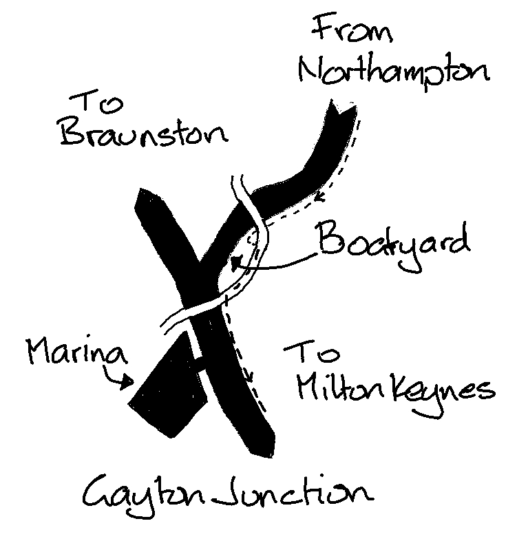
There is a steep slope at the lock under the M1. Going under the last bridge, approaching the junction, there is a sharp left turn and a short steep uphill – be warned!
2: Gayton Junction to Wolverton (14 miles)

Once you’ve climbed the steep slope to the road, turn right and follow it round to the left to head south. The towpath is compacted earth and gravel, flat and wide enough. However there are a few deep potholes in places, which are tricky when wet. This is a very nice stretch of river with lots of house boats, pubs and marinas to keep you interested.
At Blisworth Tunnel head up the slope. At the top turn left for 25m, then right onto Stoke Road. Continue on this quiet road for 1.5 miles. Where the road bears to the right into a wooded area go straight on to the footpath. This is the old path used to take horses over the tunnel and there is a descriptive board. There is a steep, rutted slope at the Stoke Bruerne end and you will need to walk your bike down here.
Once back on the towpath it is good quality as this is a popular walk – take care as it gets very busy in good weather and at weekends. After Stoke Bruerne (which has a couple of pubs and an Indian restaurant) the towpath is compacted earth and gravel to Wolverton. Bear left at the Cosgrove Marina junction with the (as yet un-restored) Buckingham Canal.
3. Wolverton to Milton Keynes (8 miles)
From now on the towpath is good, and mainly tarmacked. Wolverton Station is by the canal if you want to curtail your ride at this point. Otherwise continue towards H6 Childs Way, a main route through Milton Keynes. There is a new 3 way footbridge just before Childs Way. Take the route marked MK Centre. Ride through Campbell Park and the pedestrian paths past Centre:MK to reach Milton Keynes Central Station. Trains back to Northampton are twice an hour, and take about 20 minutes.
4. Northampton Station to Ring Way (just over 1 mile)

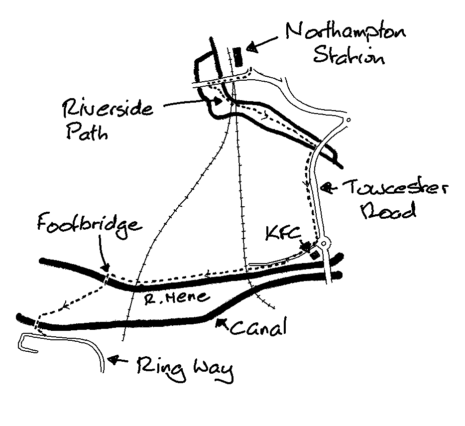
Once back at Northampton Station turn right over the railway bridge on the A4500. Just over the bridge turn left onto a path and go down to join the footpath south through the river park. At Towcester Road turn right. At the KFC turn right, then join the path heading west along the river. Turn left over the footbridge, bear left over the meadow, then cross over the canal back to Ring Way and your car.