Objective: park in between Solihull and Shirley. Cycle the Grand Union Canal from Solihull into Birmingham and up to Salford Junction. Cycle the Birmingham & Fazeley back into the centre of Birmingham, taking in the Digbeth Branch. Cycle the Worcester & Birmingham through Gas Street Basin as far as Kings Norton Junction, and then take the Stratford and Avon Canal back to Shirley Draw Bridge.
Trip Type: solo cycle (circular ride)
Distance: 28.5 miles
Time to complete: 3.5 hrs, 8.4 mph
Nicholson Guide: Guide 3 pp 132, 136, 137, 160, 161, 167, 169
Costs: free parking at Solihull. No trains required as this is a circular ride.
Difficulty: moderate (the worst section at Digbeth Branch can be avoided, making the ride FAIR)
Adjacent Rides: Fazeley Junction to Gas Street Basin, Farmers Locks to Dudley, Solihull to Leamington Spa, Shirley to Stratford, Shirley to Droitwich (?)
Overview
Quite a long ride (for me) but mostly on excellent towpaths so quite fast progress. The scenery varies from scenic rural stretches going into the city from Solihull, and heading out past Cadbury’s Bourneville factory, to very industrial sections on the Birmingham & Fazeley Canal and Digbeth Branch (which is tricky, and can be skipped if necessary). Lunch stop at Gas Street Basin if you can afford it. Some busy traffic on the first section, a main road through Solihull town centre.
1. Solihull to Salford Junction (10 miles)
Park your car on Heathcote Avenue, Solihull, B91 1GL (roughly half way between Solihull and Shirley). The first 100m of the road has no driveways and so is ideal. It is only busy when there are drop-offs at school start/end times. Head back to the junction with Danford Lane and turn right. Turn right at the roundabout onto Sharmans Cross Road, and at the end turn right onto Streetsbrook Road, B4025. Follow this to the big roundabout in Solihull town centre. Bear slightly left on Lode Lane. At the next roundabout follow signs for Lode Lane. Keep going and cross the busy A41 junction. At Rowood Drive turn right up to the canal bridge.
Access down to the canal is via steps, so if you have an electric bike you might prefer to continue on Lode Lane to where the road crosses over the canal, and access is easier down a slope.
Head north west on the towpath, towards Birmingham (i.e. as you approached the canal on Rowood Drive you are turning left). The towpath is initially compacted earth, and the scenery pleasant, but it changes to a metalled surface at Lincoln Road (Bridge 85). From the Veolia site onwards it is more industrial, and there are a series of very steep bridges over former basin entrances, which will probably require you to dismount as they can be slippery.
Approaching Birmingham city centre Camp Hill Locks are badly maintained, with lots of graffiti and weeds – not a great advert for the canals, although I’m sure in time they will be renovated. Take care as you go down the twisty flight.
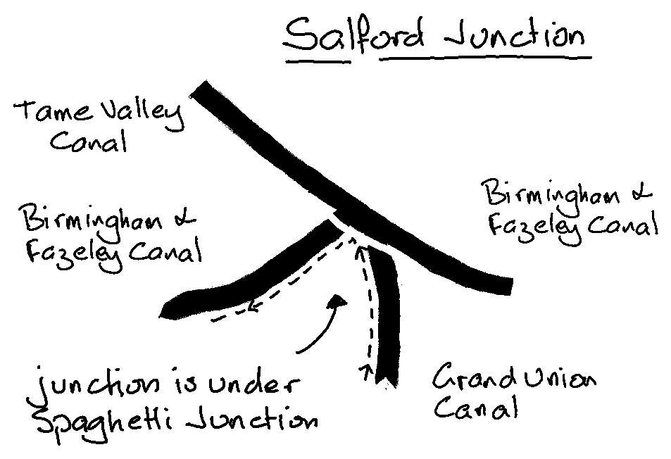
At the foot of the flight is Bordesley Junction: cross the bridge, and double back underneath it to continue on the Grand Union which heads off to the right. Again, not a very nice stretch of canal which continues 2.5 miles to Salford Junction, under the M6 at Spaghetti Junction. Admire the views of the flyovers and listen to the thundering traffic above you. Don’t stop too long or the particulates will get you.
2. Salford Junction to Gas Street Basin (3.5 miles)

You approach the junction on the left of the canal. Do not cross any bridges at this junction, but bear sharp left to head back towards the city centre on the Birmingham & Fazeley Canal.
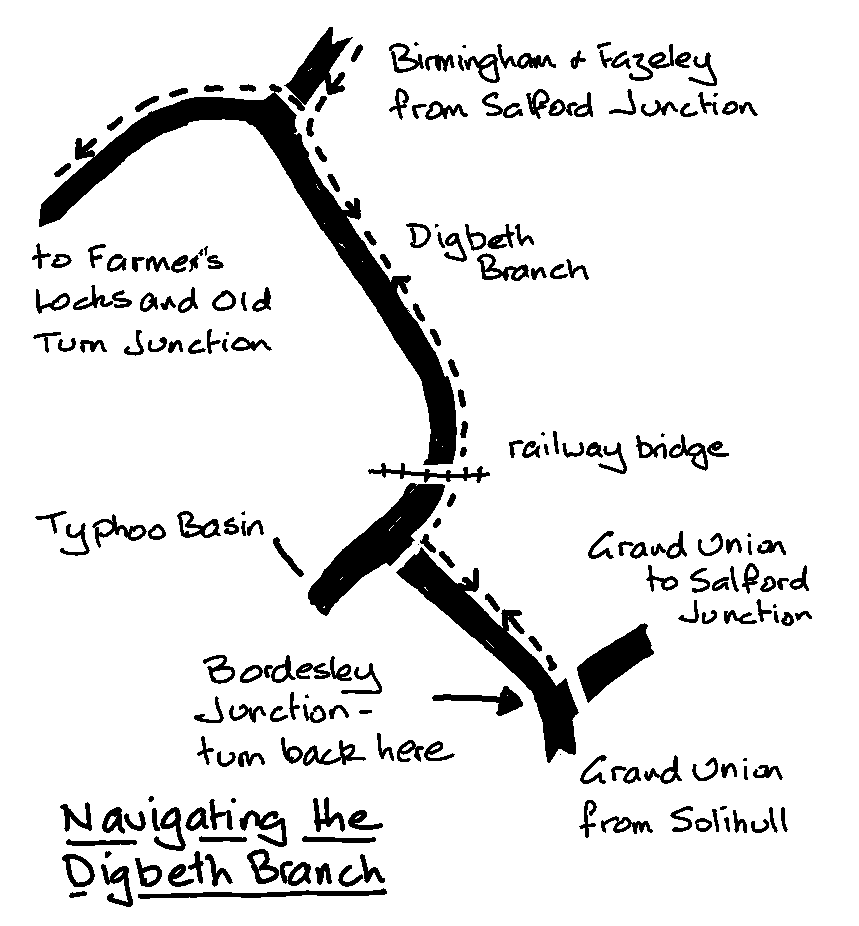
There is more industrial scenery as you climb up Aston Locks. Although the towpath is good, the many small bridges over basin entrances hinder progress somewhat. The Digbeth Branch heads off left at Aston Junction. If you are on an electric bike you may want to skip this branch and continue up Farmers Locks to Old Turn Junction.

The Digbeth Branch (technically part of the Birmingham & Fazeley Canal – I think!) is the hardest section of the ride. There are lots of obstacles: steep bridges over basin entrances; steep twisty descents at locks; 2 short tunnels with railings and curved walls making them difficult to ride.
Once under the long railway bridge turn left at the junction, otherwise you will end up in the Typhoo Basin which is closed off with a metal gate.
Arriving back at Bordesley Junction (where you turned right earlier having come down Camp Hill Locks), turn round and head back along the Digbeth Branch to Aston Junction.
Once back at Aston Junction cross the bridge and turn left. After a short while you reach the intriguing Farmers Locks, a series of 13 narrow locks with a twisting turning towpath (you will need to dismount in places) heading up under main roads and new office blocks into the hub of the Birmingham network at Old Turn Junction. Here you will find the famous canal roundabout (if you’ve done other rides of mine you may have visited it before). Cross the Birmingham Level Mainline to the far bank and turn left towards Gas Street Basin, with its many restaurants and bars.
3. Gas Street Basin to Shirley (15 miles)
You are now on the Birmingham & Worcester Canal. Continue under Black Sabbath Bridge, then Gas Street Basin on the far bank (your left), follow the bend sharp right at Granville Street Wharf (always windy here) and head out towards Edgbaston. The surroundings quickly become more scenic and life is more tranquil although you are still in the heart of the city. Edgbaston Tunnel is 75 yards long and easily negotiable. The canal heads out past the University and Cadbury’s Bournville factory, the towpath changing sides briefly at Pershore Road Bridge, and after a couple of miles reaches Kings Norton Junction. Cross Junction Bridge (bridge 72) to the Stratford Upon Avon Canal which joins to your left.

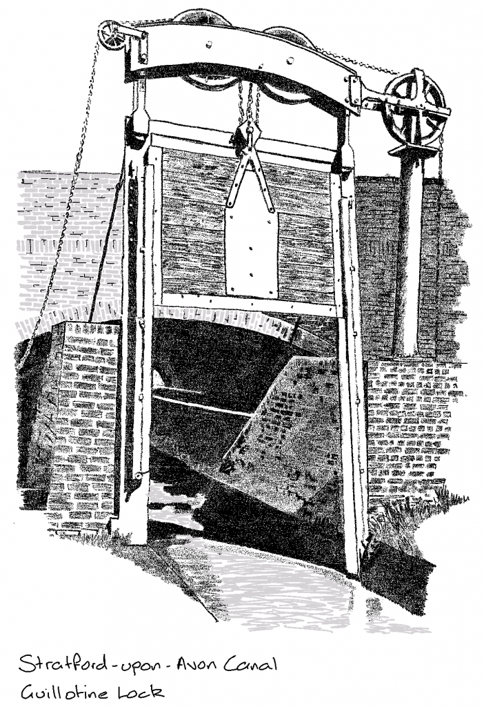
At the beginning of the Stratford Canal is the Guillotine Lock. This was built in order to preserve water between the two canals. As they were privately built and owned it was decided the few inches of difference in water levels between the two was worth maintaining, and so a lock was put in place, with the lock keeper under strict instructions not to let through any more water than was necessary to allow boats to pass.
The towpath is now compacted earth and gravel, and a bit narrower in places, but still very rideable. At Brandwood Tunnel it bears left up to a road. Turn right to the junction, and having crossed the road in front of you take the slightly hidden metalled path into the wood and back down to the towpath.
Continue to Shirley Drawbridge, a lifting bridge. Here you will find the Drawbridge Inn, which is open all day every day and you can sit outside for food and beer. Unfortunately its a Greene King, but beggars can’t be choosers.
You have 2.5 miles to go: from the pub continue down to Haslucks Green Road and turn left. Continue past the station to the roundabout where you will see The Colebrook pub. Turn right onto Velsheda Road, then left on Middleton Road. At Hurdis Road take a quick right then left into the park.
Once through the park turn right on the busy Stratford Road, then first left on Solihull Road. When you reach Danford Lane turn right, then first left to Heathcote Avenue and your car.